15 LANTERN LN UN 07
Owner Information
LECCESE ROBERTA, TRUSTEE
15 LANTERN LN UN 07
DRACUT, MA 01826


Property Details
15 LANTERN LN UN 07 is classified as a Condominium (Condominium).
The primary structure on this property was built in 1986. There are 961ft2 of built area within this property. There is 840ft2 of residential/living space within this property. This property is listed as having 4 rooms.
15 LANTERN LN UN 07 is valued at $169,700. The land is valued at $0 and the structures are valued at $169,700.
The most recent deed for 15 LANTERN LN UN 07 is recorded at the local registrar in Book 20679, Page 0023. 15 LANTERN LN UN 07 was last sold on Monday, November 6, 2006 for $1.
Assessment data from fiscal year 2022.
Flood Data
This property is partially within the AE Zone (within floodplain). Approximately 0.33 acres (26.25%) of the property is within this zone.
A portion of this property is denoted as being within a floodway.
This information is sourced from the FEMA National Flood Hazard Layer. See our full disclamer.
Broadband Internet Providers
| Provider | Type | Bandwidth (mbps) | |
|---|---|---|---|
| VSAT Systems, LLC. | Satellite | 2 | 1 |
| T-Mobile | Fixed Wireless | 25 | 3 |
| GCI Communication Corp. | Satellite | 0 | 0 |
| Comcast | Cable | 1000 | 35 |
| HughesNet | Satellite | 25 | 3 |
| Verizon New England Inc. | DSL | 15 | 1 |
| Viasat Inc | Satellite | 100 | 3 |
| Crown Castle Fiber | Fiber | 0 | 0 |
Broadband service provider data from December 2020.
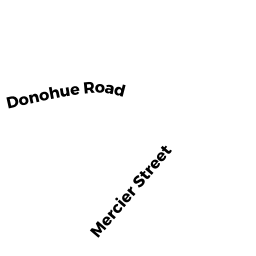
Adjacent Properties
- 23 LANTERN LN UN 01
Condominium owned by FUREY KAREN J. - 23 LANTERN LN UN 02
Condominium owned by ECKER DEBORAH L. - 23 LANTERN LN UN 03
Condominium owned by NOVELLO JASON IND. - 23 LANTERN LN UN 04
Condominium owned by BRUSH DORA - 23 LANTERN LN UN 05
Condominium owned by KASZUK WALTER A. (TE) - 23 LANTERN LN UN 06
Condominium owned by LEPINE RICHARD L. - 23 LANTERN LN UN 07
Condominium owned by PEREZ ERIC - 23 LANTERN LN UN 08
Condominium owned by SHANNON WILLIAM F - 137 DONOHUE RD
Single Family Residential owned by RODGERS MICHAEL T. - 155 DONOHUE RD
Single Family Residential owned by RILEY KEVIN T. (TE) - 165 DONOHUE RD
Two-Family Residential owned by GRAY JOAN